
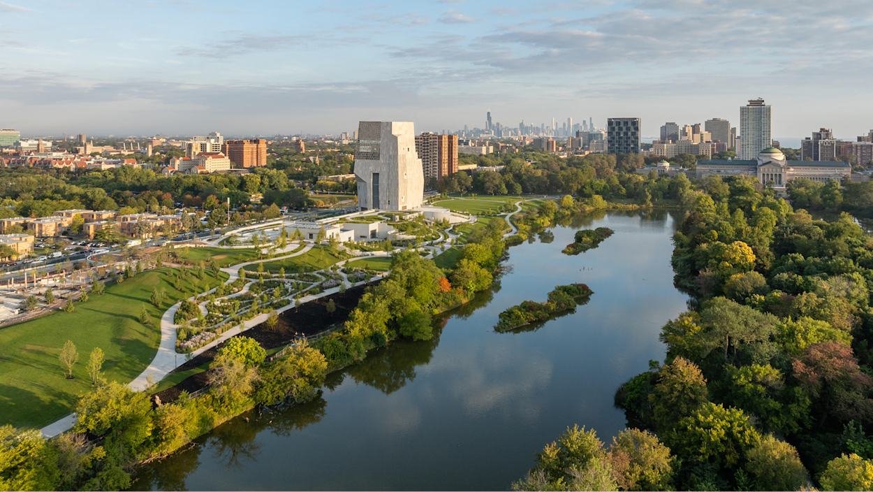
The Obama Presidential Center opens today June 19, 2026, in Jackson Park on Chicago’s South Side. For most people it is a cultural and civic landmark, the realization of a decade-long effort to build something permanent from a historic presidency. For anyone working in reality capture, laser scanning, or construction documentation, it is something else as well: one of the most technically demanding documentation projects the built environment has produced in recent memory.
That is not a claim about what happened on this specific job site. It is a statement about what a project like this demands, by law, by logic, and by the nature of what it is.
Building on a Historic Landscape Is Not Like Building on an Empty Site
Jackson Park is listed on the National Register of Historic Places. It was designed in the 19th century by Frederick Law Olmsted and Calvert Vaux, the same partnership that designed Central Park in New York. The landscape itself, its grades, its lagoons, its sight lines, its relationship to Lake Michigan, is the artifact. Not the buildings in it. The park.
When you propose to build a 19.3-acre campus on a National Register property, you trigger Section 106 of the National Historic Preservation Act. Section 106 requires a federal determination of effect before construction begins. The Federal Highway Administration conducted a three-year environmental review of the Obama Presidential Center site, and the Federal Highway Administration found that the project would have an adverse effect on the historic landscape. That finding required mitigation. Mitigation under Section 106 requires documentation, a permanent record of what existed before the change.
What that means in practice, for a site as complex and historically layered as Jackson Park, is that someone had to capture the existing conditions of that landscape in precise, defensible, reproducible detail before construction altered it. The grade of the ground. The edges of the lagoons. The canopy of the trees. The buried infrastructure from the 1893 World’s Columbian Exposition that sits beneath the surface of the park. The relationship of every existing element to every other element, in three dimensions, on a site that is constantly changing with the seasons and with the city around it.
This is the problem laser scanning was built to solve.
What Traditional Survey Cannot Do at This Scale
A total station survey of a 19.3-acre historic landscape with active water features, mature tree canopy, and complex grade changes is not impossible. It is slow, it is expensive, it is limited in the density of data it can produce, and it requires site conditions that a living urban park rarely cooperates with. You can establish control points and measure to them.
You can produce a topographic survey that satisfies a grading plan. What you cannot easily produce is a comprehensive, millimeter-accurate record of the existing landscape in its entirety, every surface, every edge, every elevation, captured at a moment in time before construction begins.
A terrestrial laser scan of a site like Jackson Park produces that record. Millions of points per second, registered across multiple setups, producing a point cloud that captures the landscape as it existed on the day of the scan. Every grade break. Every lagoon edge. Every structural element visible above grade. That dataset becomes the ground truth for the project: what the site actually was before any of it changed.
For a project that required federal documentation of a historic landscape prior to construction, that kind of capture is not a nice-to-have. It is the deliverable.
The Below-Grade Problem
The OPC campus connects its buildings underground. The museum tower, the forum building, the library, and the parking structure are all accessible at plaza level and connected below grade. The underground parking was built beneath the park surface to preserve the open character of the landscape above.
Building below grade on a historic urban park means working in close proximity to buried infrastructure you may not have accurate records for. The 1893 World’s Fair left physical traces in Jackson Park, some documented, some not. Utility systems serving the existing park facilities run through the site. The lagoons have edges and liners and drainage systems with long histories.
An as-built scan program running throughout the excavation and below-grade construction phases of a project like this is not unusual. It is standard practice on complex urban sites where the cost of a coordination failure between structural, civil, and mechanical systems during construction is measured in months and millions of dollars. You scan what you build as you build it, so that the record of what actually went in matches what the drawings said should go in, and so that every trade working underground has an accurate picture of what is already there.
The Digital Archive and What It Means for Documentation
The Obama Presidential Center is the first presidential center built around a fully digital archive. There are no physical presidential records housed on the campus. Barack Obama’s official presidential papers are maintained by the National Archives in digital form. The center does not function as a repository in the traditional sense. The history lives in the programming, the exhibits, the community engagement, and the campus itself, not in file cabinets in a controlled storage environment.
This is a significant statement about how history is preserved in the 21st century, and it maps directly onto an argument the scanning and reality capture industry has been making for years. Physical objects are temporary. The built environment changes. Buildings get renovated, landscapes get altered, entire blocks get demolished and replaced. What lasts, what remains accessible and useful decades after the physical thing has changed, is the digital record you made of it.
The Obama Foundation decided that a digital record of a presidency is more accessible, more durable, and more useful than a physical archive. That is the same argument a reality capture firm makes every time it sits down with a client who is about to renovate a building without documenting what they have. The record you create before the change is the only record that will ever exist of what was there. Once the construction starts, the existing conditions are gone.
What This Means for the Industry
A project like the Obama Presidential Center does not happen without the full stack of documentation tools the AEC industry has developed over the past two decades. Existing conditions capture of a National Register historic landscape. As-built scanning through a complex below-grade construction sequence. Coordination of multiple structures connected underground on a constrained urban site with active park facilities running throughout construction.
None of this is theoretical. It is what the project required, by regulation, by complexity, and by the nature of building something meant to last. The tools that make that possible are laser scanning, point cloud processing, BIM coordination, and the firms that know how to deploy them on projects where the stakes of getting it wrong are measured in historic resources that cannot be replaced.
The presidential record is digital because that is how you preserve something for the long term. The existing conditions of Jackson Park were documented before construction because that is how you build on something historic without destroying it. Both of those decisions reflect the same underlying truth: the record you make of the physical world is what outlasts the physical world.
That is the work.
Rogue Visual Design is a woman-owned 3D scanning and reality capture firm based in Kansas City. We provide laser scanning, point cloud processing, BIM, UAV services, and photo documentation for commercial construction, architecture, and engineering teams across the region.